|
|
|
| Turpan | |
|
Uyghur Photo Site |
Site Manager |
Contact Page |
Information |
In the World |
Kashgar-Atush |
Turpan |
Urumchi-Qaramay |
Qumul-Korla |
Hoten-Aksu |
Ili-Altay |
Kucha |
People |
Culture |
Nature |
Favorite Links |
Uyghur Photo Guest Book
|
|
|
Here are some pictures of Turpan
|
|
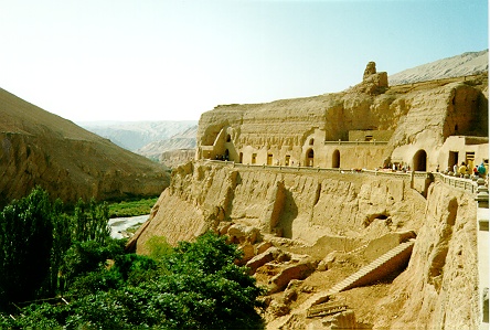 |
Bizaklik Thousand Buddha Caves Bezeklik Thousand Buddha Caves are found on the cliffs of the Valley in the Flaming Mountains, 50km (31 miles) east of Turpan. There are 77 caves dating from 420-589 to the Monggol Empire(1280-1368) and at one time they contained beautifully colored Buddhist murals. The murals were not only artistically stunning but also anthropologically important. Unfortunately, few murals of good quality remain at the caves many were taken by the German Von Le Coq in the early 20th century. While excavating the site he discovered the artistic masterpieces and decided to cut out the murals and transport them for sale in Europe. Others murals were defaced by Uyghur locals, who feared the omnipotent powers of the Buddhist images and believed that digging out the eyes and mouths would disable their supposed powers. Although the caves do not match their former glory, visitors will enjoy the natural beauty of the surrounding landscape. |
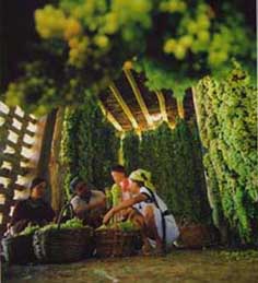
| Grape Valley On the western face of the Flaming Mountains, east of Turpan is the Grape Valley. Despite the sweltering summer heat that hits Turpan, this 8km (5 mile) long valley remains cool and humid. Grapes were first grown in the city over 2,000 years ago and together with Turpanââ¬â¢s melons and wines, soon became the regionââ¬â¢s specialty products. The Grape Valley is filled with trellised walkways, that in the peak season of July to August, are covered with bunches of grapes. The valley produces the famous seedless white grape, the munaqi or ââ¬Ëmareââ¬â¢s nippleââ¬â¢ grape, and red and black grapes in the fall. Peaches, apricots, apples, pomegranates, pears, and various types of melon are also grown here. In the valley you will find a park as well as patios and outdoor tables where you can eat the grapes and other fruit or enjoy a delicious meal complemented by the locally produced wine |
 |
 |
Atsana Graves Atsana Graves lie northwest of the Ancient City of Astane and is where imperials of the city were buried between the 3rd and 9th centuries. Most of the artifacts found in these tombs date from the same period and include silk brocades , paper burial objects and other items of daily use. The objects are in excellent condition as they have been well preserved in the dry climate. 3 of the tombs are open to tourists and are entered through steep and narrow passageways that lead to burial chambers about 6 meters (20ft) below the ground. 2 of the tombs are decorated with simple paintings - the first of auspicious birds the other depicting persons . The last tomb contains well-preserved mummies of a man and woman. |
|
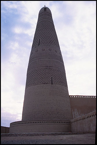
Emin Minaret
Emin Minaret, 3km (2 miles) east of central Turpan is an architectural delight. Construction of this religious tower and mosque complex began in 1777 at the request of the then ruler of Turpan Emin Khoja. The circular tower, designed by a Uighur architect, is 44 meters (144ft) high. It is made of sun dried bricks and is decorated with delicate geometric and floral patterns. The adjoining mosque has a latticed ceiling and a domed sacred space, all supported by wooden pillars. From the top of the mosque there is a good view of the surrounding vineyards and mountains. |
 |
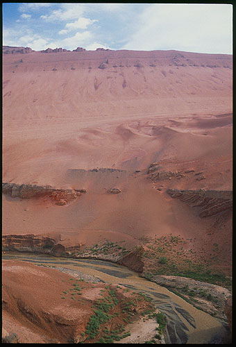 |
Flaming Mountains Flaming Mountains are red sandstone hills on the northern edge of the Turpan Basin. The red of the hills has been likened to burning flames and temperatures often reach a sweltering 55ðC (131ðF). |
|
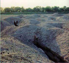
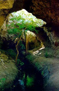
Karez Irrigation System
The Karez is an underground irrigation system that was constructed over 2,000 years ago and is considered 1 of the greatest engineering achievements of ancient Times, It is a series of wells and underground channels that transferred water, usually from the glaciers on the base of the Tangri Tagh, to communities in the area. Many cities on the ancient Silk Road, some as far west as modern Iran, relied on this irrigation system as a primary supply of water |
 |
|
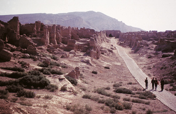
Ancient City of Ediqut The Ancient City of Ediqut is 10km (6 miles) west of Turpan in the Yarnaz Valley. Ediqut ruins are located on top of a 30 meter (98ft) cliff carved out by 2 long dried up rivers. 2000 years ago, Ediqut was powerful and important - and was eventually become the capital of the Uyghur empire in the 9th century BC. The city was at its cultural peak under the Uyghurs, but Mongol rebellions led to its demise and by the Monggol Empire (1280-1368AD) Ediqut was deserted. The dusty ruins reveal the structure of the city - the impressive 1,650 meter (5,410ft) long city walls and the huts, temples, watchtowers, courtyards, streets and wells. A Buddhist monastery complete with dagoba, stands in the center of the city and inside there are the remains of several headless statues of the Buddha enclosed in niches. |